Cypress Hills—Saskatchewan and Alberta
Interactive Map
Planning Tips
There are multiple provincial park campgrounds spread across Alberta and into Saskatchewan.
Nearby destinations include Writing on Stone, Grasslands National Park and Lake Diefenbaker. This is also a perfect stop if traveling to or from the major national parks in the Canadian Rocky Mountains.
Basic services are available in Elkwater, Alberta or inside the Park in Saskatchewan.
Highlights
Highlights include: regional description, major points of interest, etc.
Video
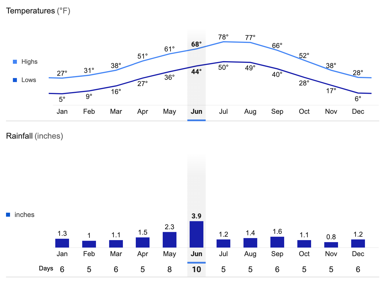
Elkwater, AB Average Temperatures and Rainfall