Yellowhead Highway—Alberta & British Columbia
Interactive Map
Planning Tips
There are multiple campgrounds near the major stops. Others can be found on the Campgrounds map.
The Stewart-Cassiar Highway connects with the Yellowhead at Kitwanga. Edmonton and Jasper are near other destinations. For more information, see the Destinations Map.
Services and entertainment options are available along the way in the numerous towns and villages. Major services are best attended to in Edmonton or Prince Rupert.
Highlights
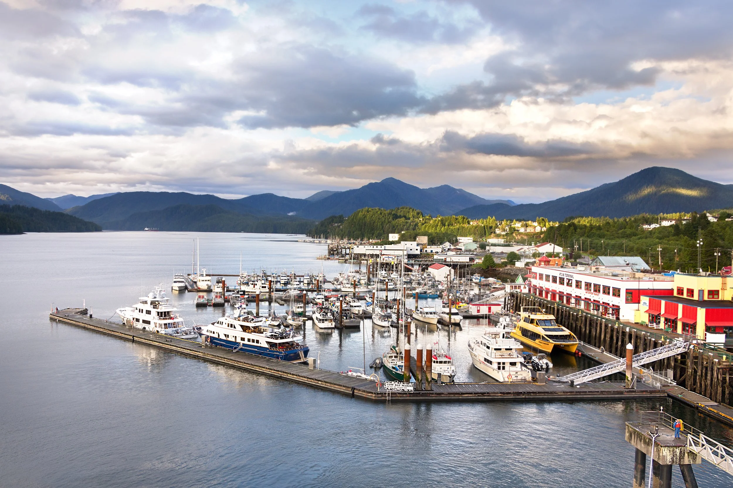
The Yellowhead Highway technically begins in Manitoba, but this route concentrates on the section running from Edmonton to Prince Rupert. This 1100 mile (1770 km) stretch of highway traverses the Rocky Mountains and then extends through some of the most remote sections of British Columbia. The route then terminates at Prince Rupert and the Gulf of Alaska.
Here are the recommended stops:
Video
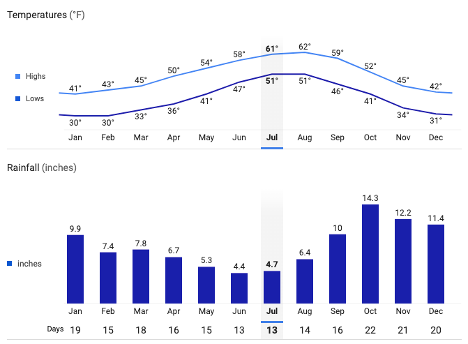
Prince Rupert Average Temperatures and Rainfall