Cabot Trail—Nova Scotia
Interactive Map
Planning Tips
There are several Parks Canada campgrounds on the northern end of the Cabot Trail and a single provincial park in the south. There are private campgrounds, if you are set on staying elsewhere along the route.
Since you’re up there, consider checking out the southeastern half of Cape Breton.
This is the remote half of the peninsula. Baddeck on the southern end of the trail is the best opportunity for services and entertainment, but basic services are available along the route. Sydney on the eastern half of the cape is the best bet for major service needs.
Highlights
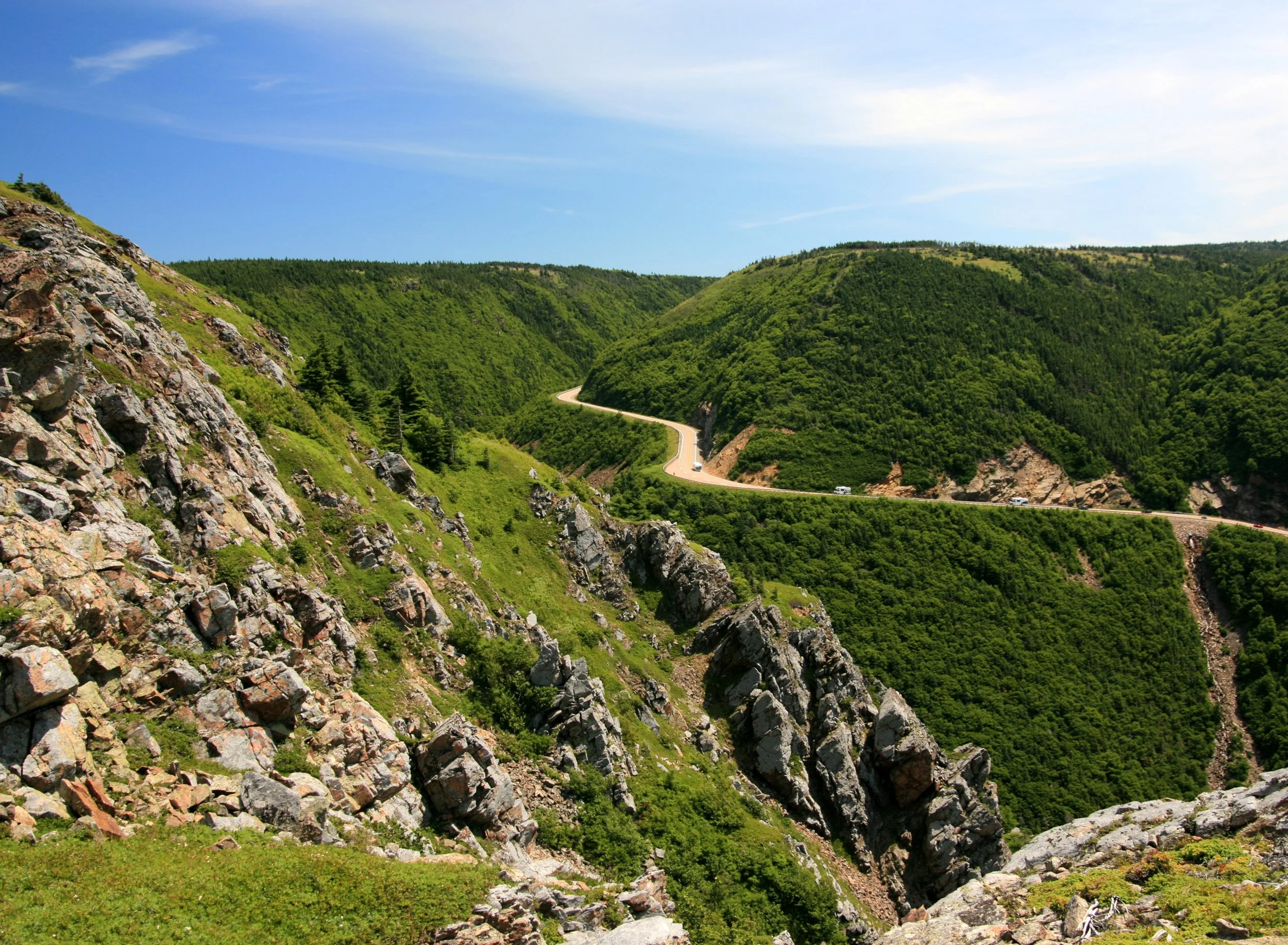
This is a 185 mile (300 km) loop around the northwestern Half of Cape Breton, Nova Scotia. The route is named after the explorer John Cabot who made landfall in the Atlantic Provinces in 1497.
The road winds through the hills of the north cape offering stunning views of the Atlantic coast. This passage also connects travelers with trailheads leading into Cape Breton Highlands National Park.
Other major points of interest along the Cabot Trail are the old Acadian fishing village of Cheticamp, whale watching opportunities around Pleasant Bay and the Alexander Graham Bell National Historic Site in Baddeck. Of course, this is only part of what you will see. Lighthouses, towering seaside cliffs and waterfalls are spread along this exceptionally scenic coastline.
Cabot Trail has all the elements that make it one of North America’s most incredible drives.
Video
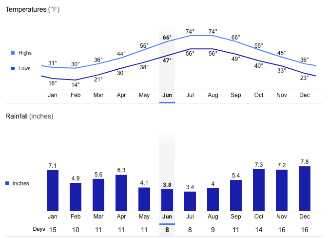
Neils Harbor Average Temperatures and Rainfall