Stewart-Cassiar Highway—British Columbia
Interactive Map
Planning Tips
There are several provincial campgrounds spread along the route. Other private campgrounds are available.
The Alaska and Yellowhead Highways are at either end of this route.
See the map for basic service options along the route. Dease Lake is the only substantial village along the road.
A combination of the Stewart-Cassiar and Yellowhead Highways can be an alternative to the Alaska Highway.
Highlights
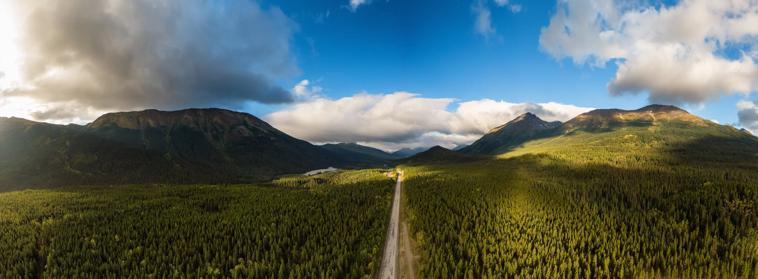
The Stewart-Cassiar Highway runs 350 miles (565 km) from the Alaska Highway in the north to the Yellowhead Highway in the south. The road parallels the Coastal and Boundary Mountains through some of the most remote regions of British Columbia accessible by road.
The route offers a much more off-grid alternative to the Alaska Highway connecting travelers with difficult to reach sections of British Columbia. There are only a few roads in North America more remote than this one.
Video
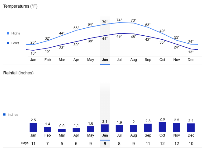
Kitwanga Average Temperatures and Rainfall