Haines Highway—Alaska and Yukon
Interactive Map
Planning Tips
There are numerous campgrounds along the route.
This route connects to the Haines ferry terminal in the south and Haines Junction and the Alaska Highway in the north.
You will fine service and entertainment options primarily in Haines, Alaska and Haines Junction, Yukon.
Highlights
The Haines Highway runs north from the ferry terminal in Haines, Alaska, through British Columbia and intersects the Alaska Highway in Haines Junction, Yukon. The 110 mile corridor has been greatly improved from the days when it was referred to as the Yukon Road and was subject to frequent closure due to avalanche, washout or snow.
This route probably makes the most sense if you are arriving or departing by Ferry to Juneau or other southern ports. Regardless, it is a remote, but beautiful stretch or highway.
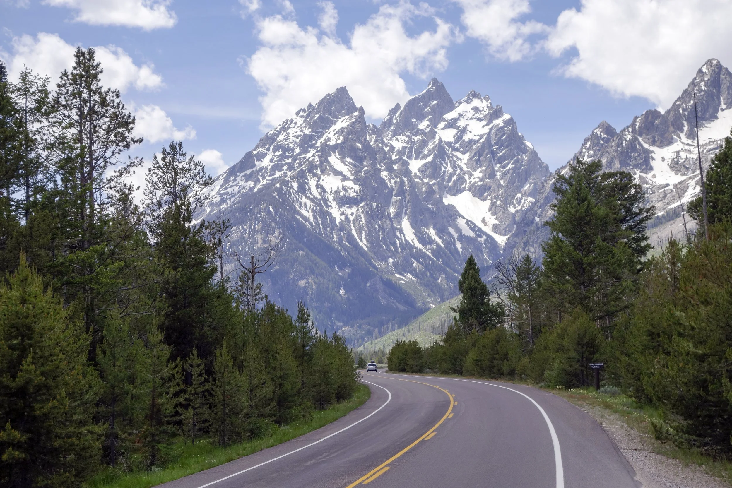
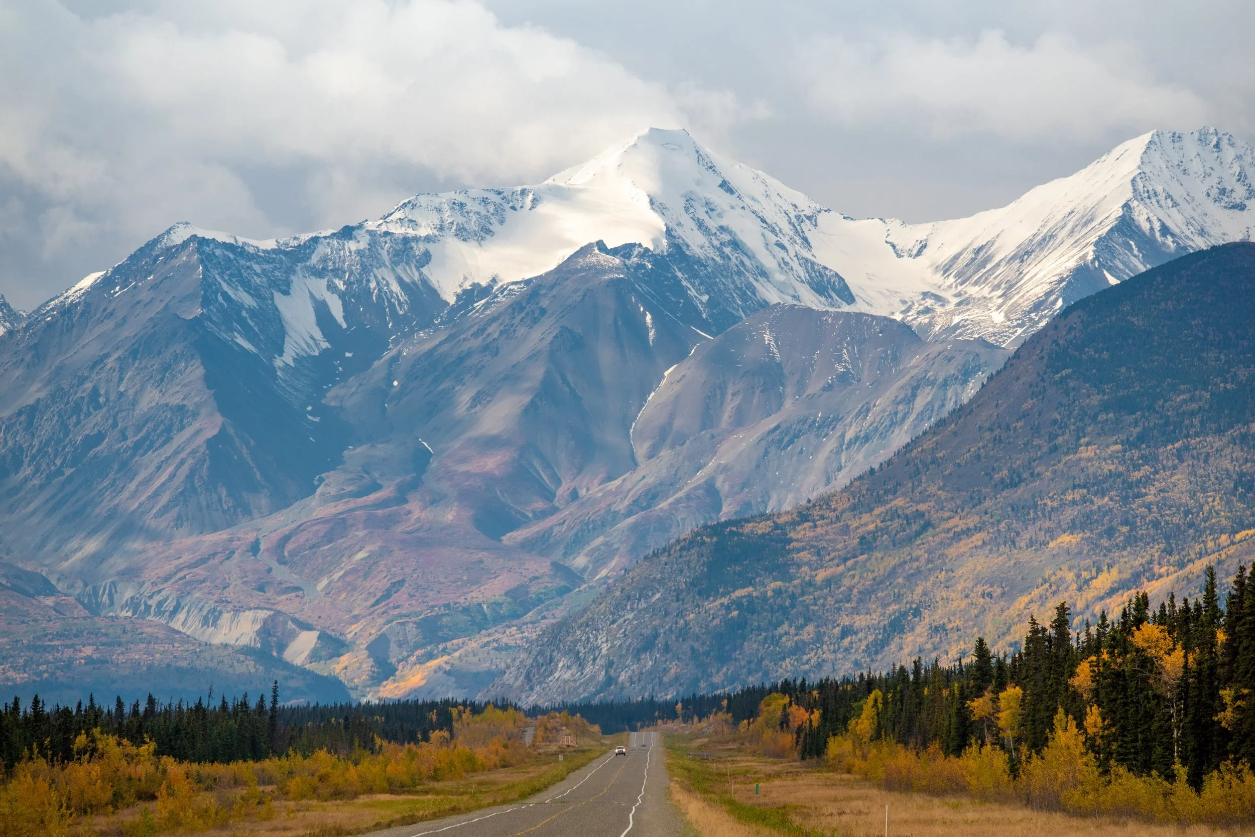
The roadway climbs and reaches its summit in British Columbia. The Yukon section parallels Kluane National Park. It also passes by many mountain lakes and wild rivers. Large wildlife, like bears, are common sights along the drive.
The Haines Highway is one of many incredible northern routes. If it makes sense, it will be a great adventure.
Video
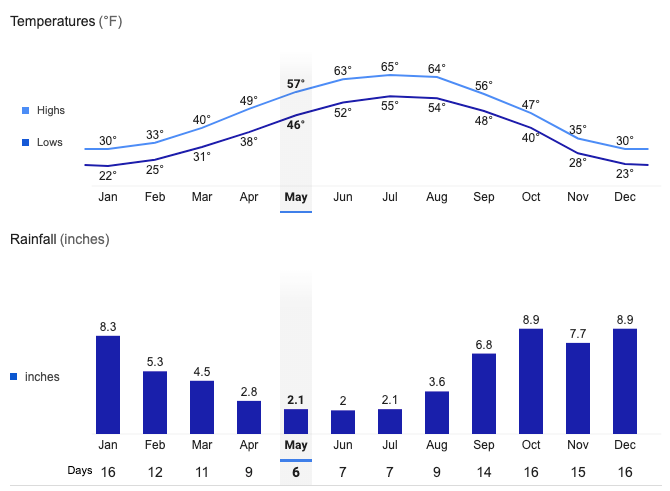
Haines, Alaska Average Temperatures and Rainfall